

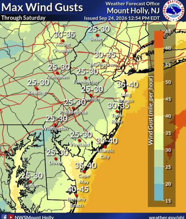
Residents in the Hopewell Valley could see gusty winds and periods of rain this weekend as a developing coastal storm moves along the region, although the most significant impacts are expected closer to the Jersey Shore.
The National Weather Service has issued a Wind Advisory for Mercer County from 6 p.m. Friday through 6 a.m. Sunday, with north winds of 15 to 25 mph and gusts as high as 45 mph possible. The Weather Service said the winds could blow around unsecured objects, bring down tree limbs and result in some power outages.
The advisory comes as forecasters continue to monitor a developing low-pressure system off the East Coast whose exact track will determine how much rain and wind reaches inland New Jersey.
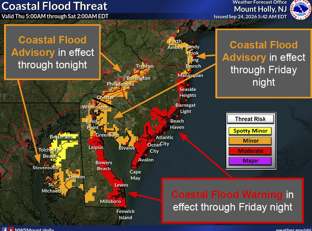
In a Thursday afternoon briefing, the National Weather Service’s Mount Holly office said forecast confidence decreases beginning Friday and particularly over the weekend because conditions will depend heavily on the storm’s track. If the low remains closer to the coast, rain and stronger winds could extend farther inland. If it tracks farther east, the more significant effects would remain concentrated along the coast.
For the Hopewell area, the current forecast calls for a mostly cloudy Friday followed by a wetter weekend. Rain is expected Saturday and Sunday, with temperatures in the 60s. The National Weather Service forecast for Hopewell Thursday evening called for wind gusts around 30 mph Saturday, although the newer countywide advisory indicates gusts could reach 45 mph in parts of Mercer County.
Conditions are expected to be considerably more severe along the Jersey Shore.
The Weather Service’s Thursday briefing called for northeast winds of 25 to 35 mph along the Atlantic coast, with gusts up to 50 mph, along with coastal flooding, dangerous surf and significant beach erosion. A High Wind Watch was issued for portions of the coast for Friday night into Saturday.
Pennington Borough also alerted residents this week to the possibility of severe weather, sharing storm-preparation information from PSE&G.
The utility said it had activated its storm response plan and positioned additional crews and resources across its service territory ahead of the storm.
“We’re closely monitoring the evolving forecast and potential impacts across the areas we serve,” PSE&G Vice President of Electric Operations Paul Toscarelli said. “Our focus throughout the storm will be on responding safely, restoring customers as quickly as conditions allow and keeping them informed along the way.”
PSE&G encouraged residents to charge phones and other essential electronics, have flashlights and batteries available and secure outdoor furniture and other loose objects that could become airborne in strong winds.
The National Weather Service also recommends securing outdoor objects during the Wind Advisory and cautions that driving could become difficult, particularly for high-profile vehicles.
Forecast details could continue to change as the storm develops and its track becomes clearer