The New Jersey Department of Environmental Protection (NJDEP) has cited Mercer County and its contractor after large amounts of clay and sand from a bridge-repair project entered the Stony Brook last weekend, clouding the waterway and coating streambeds with thick layers of sediment.
In a statement Friday, Oct. 10, the NJDEP said it issued Notices of Violation and an Emergency Authorization under the Flood Hazard and Freshwater Wetlands rules, directing the county and its contractor to halt unpermitted activities, remove the material, and submit weekly restoration updates.
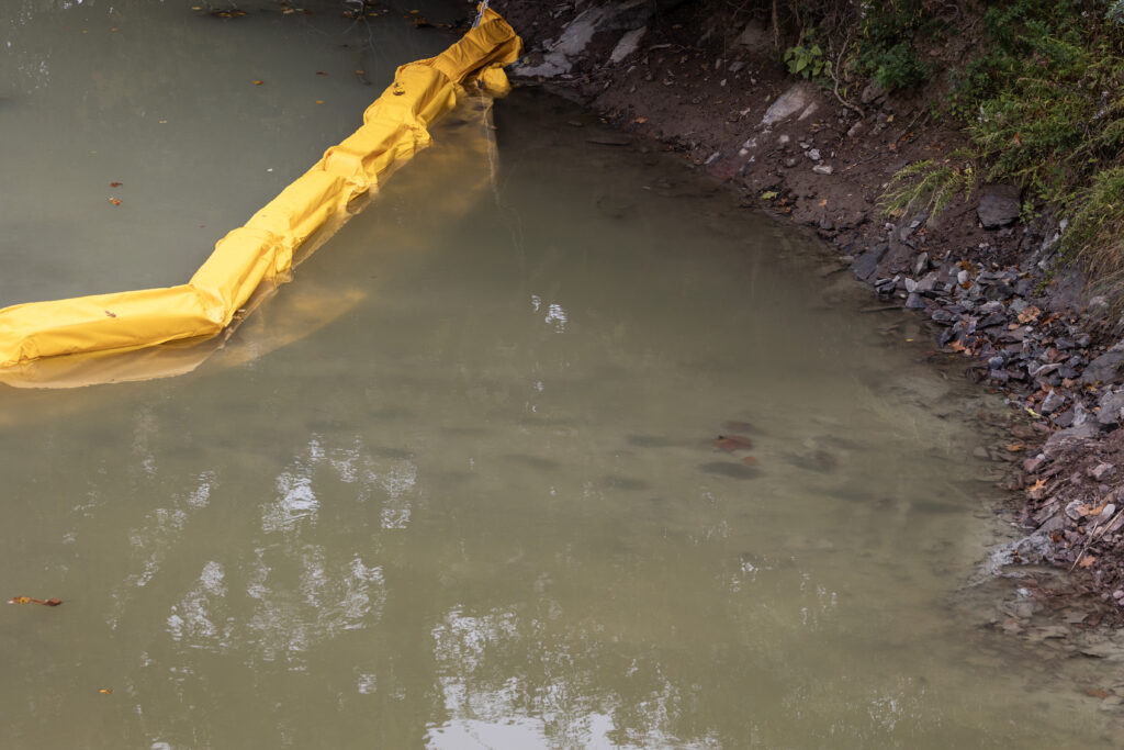
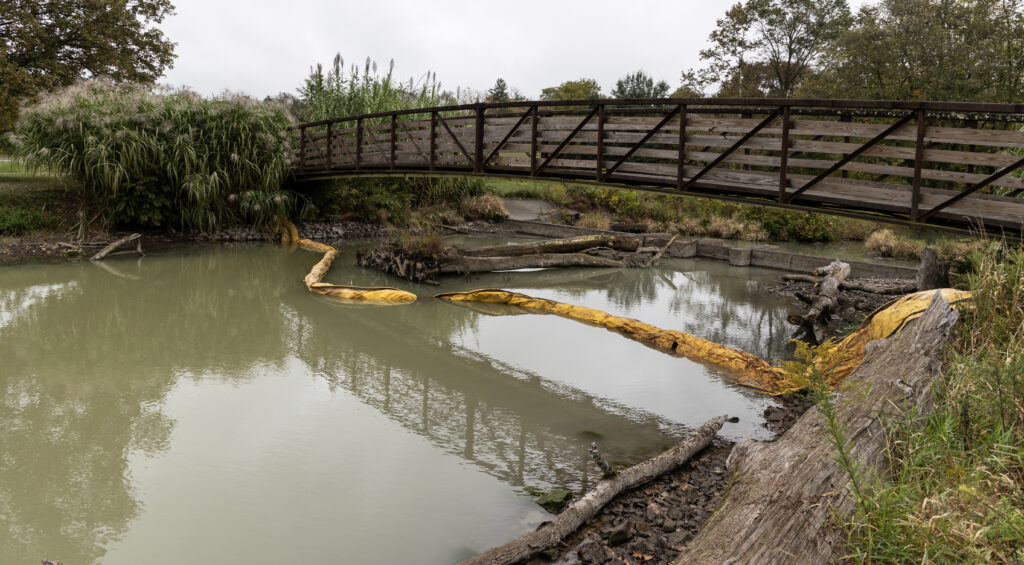
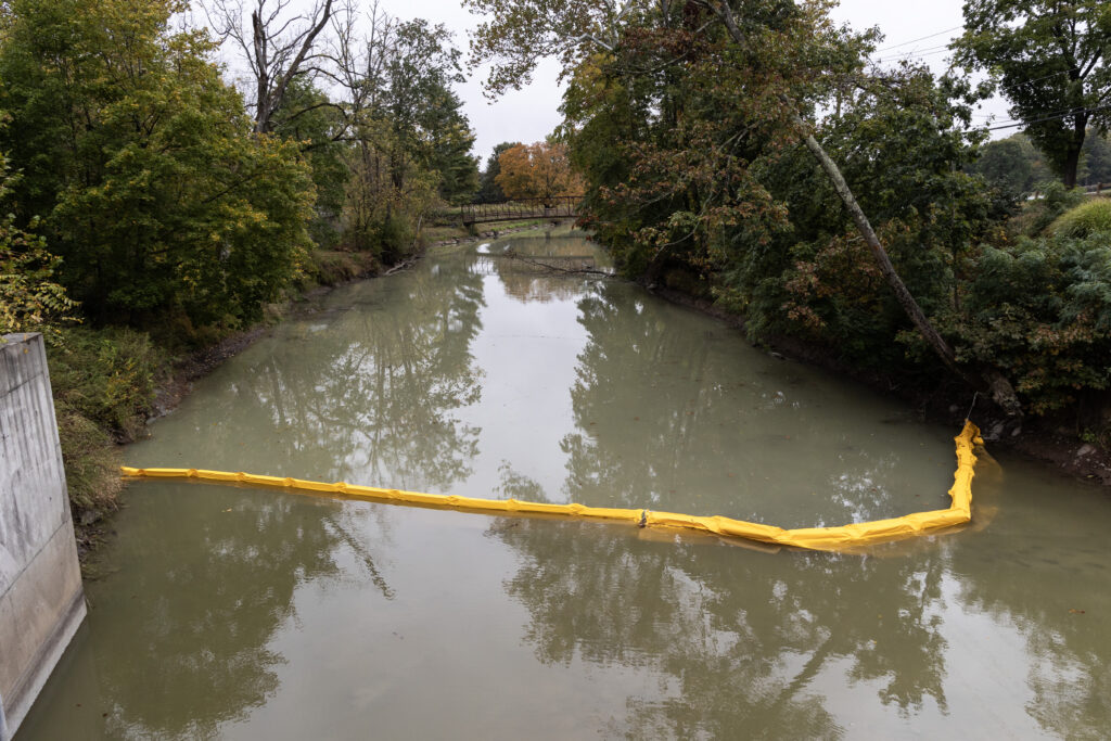
Inspectors determined that the sediment came from quarry materials stored in a wetland beside the brook during emergency repairs to County Bridge #230.10 on Pennington-Hopewell Road, near Hopewell Valley Golf Course. The department required that turbidity barriers—the bright-yellow floating curtains now visible at several points along the waterway—be installed to limit further downstream spread.
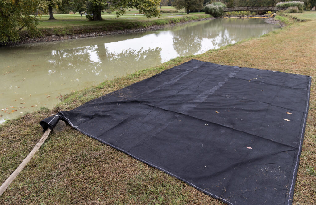
Over the weekend filter bags could be found on the shoreline as teams will attempt to filter out clay, but reports from the weekend were that first attempts were not successful.
“A violation is a violation”
Jim Waltman, executive director of The Watershed Institute, said Friday that while he welcomed the state’s enforcement action, the damage to aquatic life is already evident.
“It’s like 15 inches thick at least, and that’s for a good stretch of the stream,” Waltman said. “You can’t dump sediment into a stream—whether it’s a Category 1 designated stream or not. Any life that lives on the bottom is now dead.”
Although NJDEP classified this reach of the Stony Brook as not Category 1, Waltman noted that distinction “doesn’t mean we need to be dumping clay in there.” He said the material had already drifted farther downstream toward the Watershed’s own preserve property by Friday afternoon.
In New Jersey, Category 1 (C1) waterways are the state’s most highly protected streams and rivers, designated by the NJDEP for their exceptional ecological, recreational, or water-supply significance. This classification prohibits any activity that would cause measurable changes in water quality, including increased pollutant loads or disturbance to the stream corridor. C1 status typically extends 300 feet of buffer protection on either side of the waterway, limiting development and requiring stricter stormwater controls. While the section of the Stony Brook affected by the recent sediment release is not classified as Category 1, likely because it runs through a golf course, other portions of the brook are, reflecting its broader environmental importance within the watershed.
County response
Mercer County said the incident occurred as the contractor removed an earthen dam used to reach the bridge’s scoured foundation.
“The construction on the bridge was recently completed, and during the contractor’s removal of the earthen dam, some silts and clays were kicked up and released into the stream, resulting in a grayish discoloration,” the county said last week. Crews have since added sediment bags and repositioned the stockpile away from the water, covering it with plastic.
County officials said they are coordinating with the Mercer County Soil Conservation District and NJDEP “to ensure that these conditions are resolved, and that our natural environment is protected.”
Watershed monitoring continues
The Watershed Institute, headquartered just downstream of the site, continues to monitor and track the movement of the sediment through the Stony Brook system, a tributary of the Millstone River. Waltman said staff members are investigating in-stream sensors capable of providing real-time turbidity readings.
“We have concerns for the stream itself, but also for the portion that flows through our property, which we manage in trust for the public,” he said. “Any pollution of that stream degrades the land we’re charged to protect.”
The rain we are getting now will be a test of the barriers. Waltman warned that several inches of precipitation could resuspend the clay deposits and push them farther downstream into sensitive wetlands and the Millstone River corridor.
Next steps
Under the state’s order, Mercer County and its contractor must submit a written restoration plan to NJDEP and provide weekly progress reports until conditions stabilize. DEP Fish and Wildlife and the agency’s Watershed Land Management office are reviewing potential ecological impacts.
By the weekend, the water in the affected stretch remained noticeably opaque, with footprints visible in the settled sediment along the banks where workers installed turbidity curtains. Bright yellow booms stretched across multiple bends of the Stony Brook, and piles of gray clay and rock were still visible near the bridge.
The Watershed Institute continues urging close coordination among the county, DEP, and local partners to restore the brook’s health. “The Stony Brook is a vital artery in this watershed,” Waltman said. “It’s going to take time and care to bring it back.”