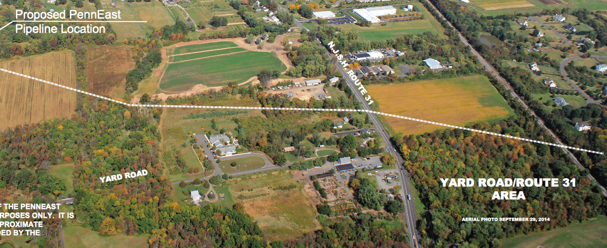
The proposed route of the PennEast gas pipeline has been difficult to put into perspective. Thus far, most of us have had to base our understanding with preliminary maps that are the detail equivalent of a 1950s black and white TV. Get ready for high definition.
Some communities have tried to put the pipeline route in “real world” terms by marking road crossings with signs. Others have plotted the proposed path over digital tax maps. Hopewell Township has taken things up a couple of notches and is showing – for illustrative purposes only – an interpretation of the route superimposed on areal photographs taken just last week. Prepared (and likely taken) by the Township’s administrator and engineer Paul Pogorzelski, the PDF shows the pipeline’s path into Mercer County from the north, to its proposed connection to the existing Transco pipeline off of Blackwell Road all in beautiful and frighteningly real detail.
For the full map, click here. We extend our thanks to Paul and the Township for putting the photo depiction together.


