The Hopewell Valley and much of New Jersey are now under a Winter Storm Warning as forecasters warn of a significant winter storm expected to bring heavy snow, gusty winds, and hazardous travel from Sunday morning through Monday afternoon.
The National Weather Service upgraded the region from a watch to a warning early Saturday, citing increasing confidence in widespread impacts across the state. Coastal New Jersey faces blizzard conditions, while inland areas including Mercer County are expected to see heavy snowfall and blowing snow.
Forecasters say precipitation will likely begin Sunday morning, potentially starting as rain before changing to snow by late morning or afternoon. The heaviest snowfall is expected Sunday evening through Monday morning, with travel disruptions likely during both the Monday morning and evening commutes.
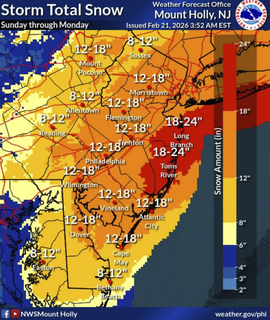
Snow totals across central New Jersey are projected in the 12- to 18-inch range, with at least a moderate probability of exceeding a foot in many areas. Winds will also strengthen through the storm, with gusts up to 40 mph possible inland, potentially causing blowing and drifting snow, reduced visibility, and scattered power outages.
The Weather Service warned that the combination of heavy snowfall and wind could lead to “very difficult to impossible travel conditions” and widespread disruptions to transportation and infrastructure.
The storm is expected to taper off Monday afternoon.
Residents are urged to complete storm preparations by Sunday morning and avoid unnecessary travel during peak snowfall Sunday night into Monday.