In a shift from the way stormwater has traditionally been managed, four municipalities in the Stony Brook watershed are working together to develop a single, regional plan to address flooding and water quality.
The effort—bringing together Hopewell Township, Pennington Borough, Lawrence Township, and Princeton—is part of New Jersey’s updated Municipal Separate Storm Sewer System (MS4) permit requirements, which call on towns to reduce pollution and better manage stormwater runoff.
Rather than each municipality creating its own plan, the four towns are coordinating across municipal boundaries through a process led by The Watershed Institute.
A recent public meeting marked the first time a meeting like this happened where multiple municipalities come together to discuss the Stony Brook watershed as a single system.
A regional approach to a shared problem
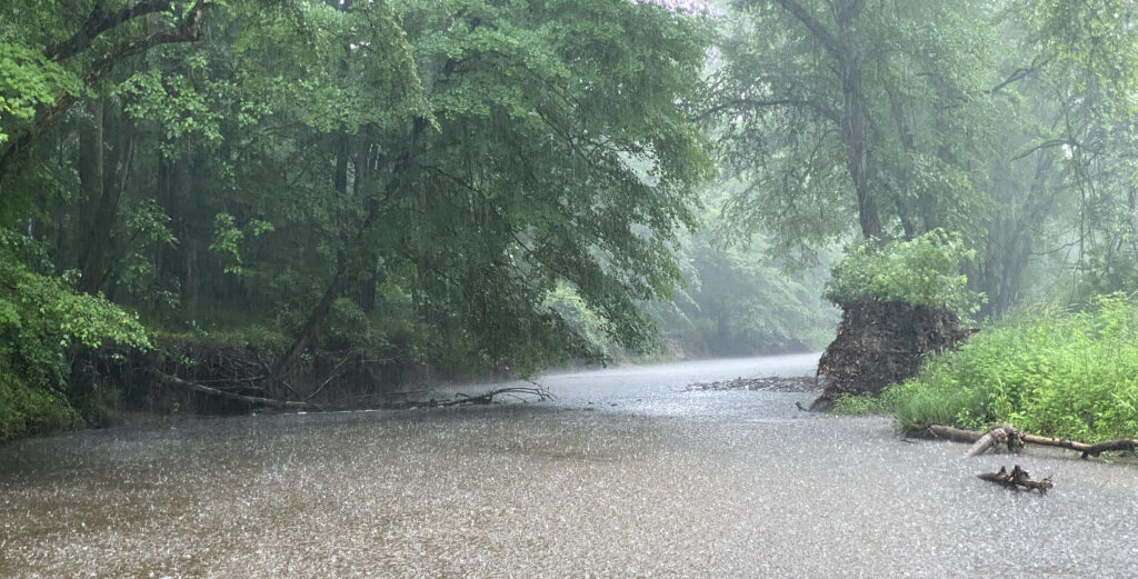
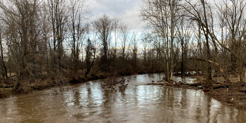
The Stony Brook watershed spans multiple municipalities, carrying stormwater—and the pollutants it contains—across town lines before ultimately flowing into Carnegie Lake in Princeton.
That interconnected system is one of the key reasons behind the regional approach.
“These municipalities can’t deal with flooding all by themselves, because they only control some fraction of that water,” said Michael Pisauro, policy director at the Watershed, in an interview following the meeting.
Pisauro said the collaboration represents a significant shift from the traditional “home rule” mindset in which municipalities manage issues independently.
“Towns in New Jersey are very home rule oriented, saying don’t tell me what to do,” he said. “But I think after Ida, towns started to recognize I can’t deal with flooding all by myself.”
Instead, the MS4 permit provides a framework for municipalities to work together on watershed-scale solutions.
Without that coordination, Pisauro said, towns risk developing plans that don’t align with one another.
“You have ten, fifteen plans that aren’t going to work because they all have different assumptions,” he said.
Science points to erosion, stormwater as key drivers
At the meeting, consultants presented water quality data collected throughout the watershed, highlighting both improvements and ongoing challenges.
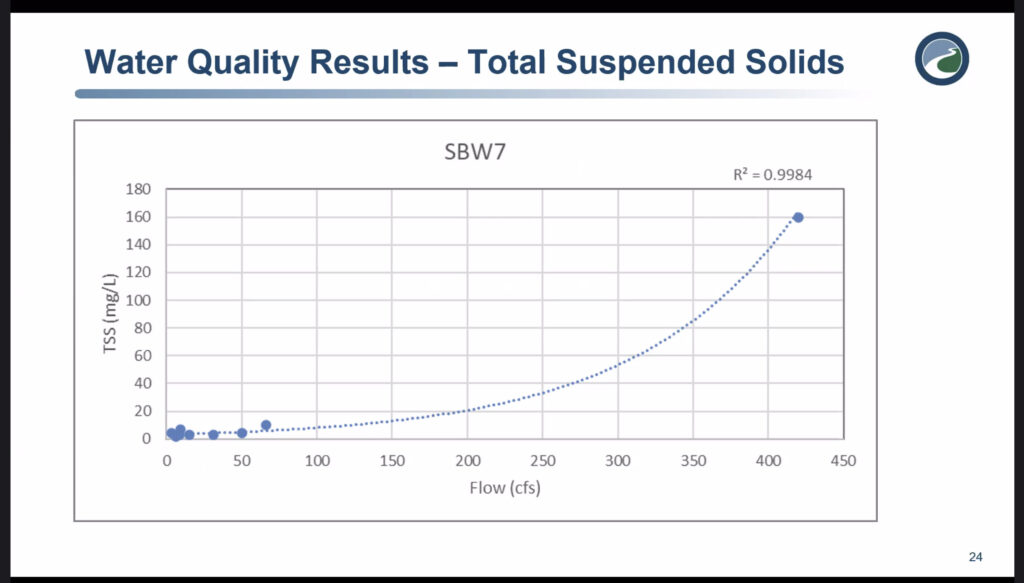
One of the most consistent findings involved total suspended solids—sediment carried in stormwater—which increases sharply during storm events and is closely tied to streambank erosion.
“We don’t have to waste a lot of time… trying to filter out sediment,” said engineer Jim Cosgrove from One Water Consulting during the presentation, noting that the issue is less about filtering and more about controlling the forces that move sediment into streams.
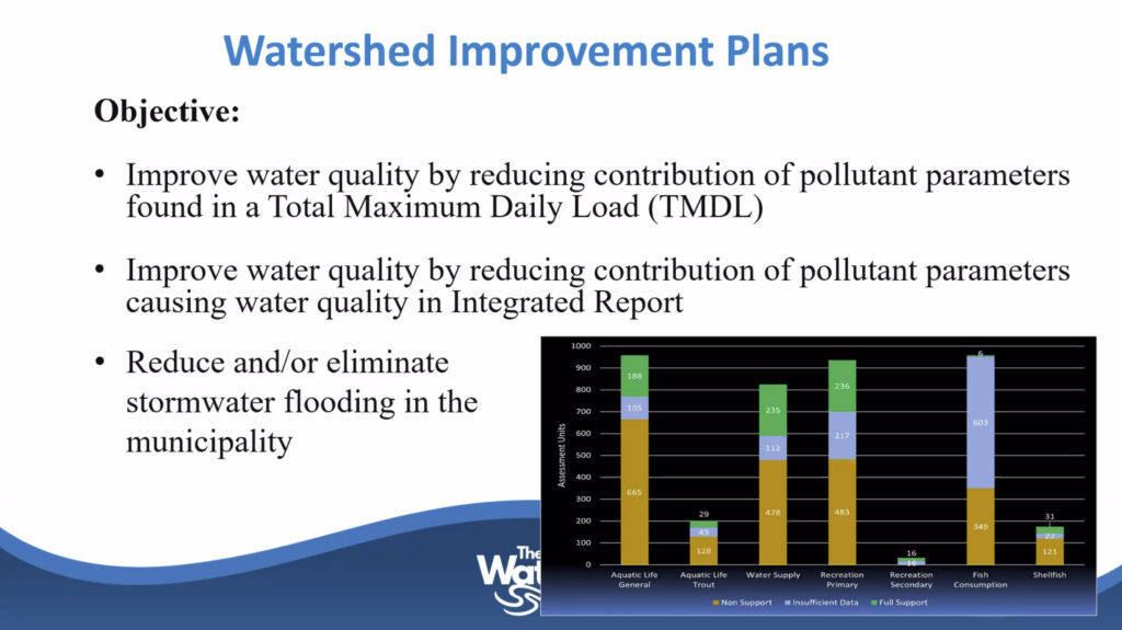
Phosphorus levels were shown to exceed state benchmarks across monitoring locations, while nitrogen levels have improved over time.
Dissolved oxygen levels, an indicator of stream health, were generally found to be within acceptable ranges.
The data is tied to federally required pollution limits, known as Total Maximum Daily Loads (TMDLs), which set reduction targets for pollutants including phosphorus, sediment, and bacteria.
From data to projects
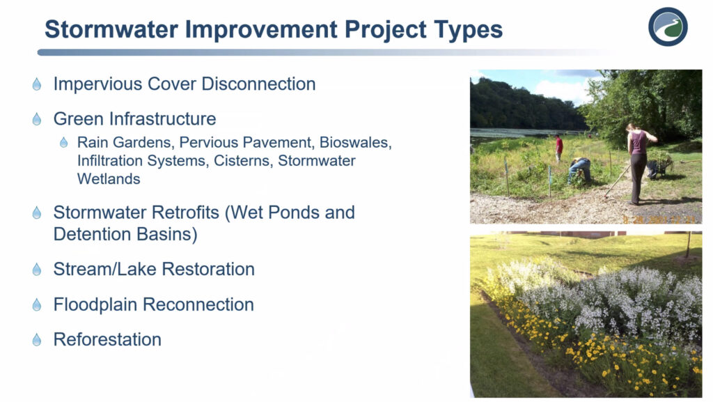
The planning process will translate that science into specific projects aimed at reducing runoff, improving water quality, and mitigating flooding.
Potential strategies include:
- Green infrastructure such as rain gardens and bioswales
- Retrofitting stormwater basins
- Stream and floodplain restoration
- Reducing impervious surfaces
One of the central ideas behind the regional approach is that projects may be located in one municipality but benefit another.
Pisauro said that kind of coordination can make solutions more effective and more cost-efficient.
“Princeton may pay part of the cost of a project in Hopewell to reduce flooding and improve water quality in Princeton,” he said, noting that upstream work can often produce downstream benefits.
Public input plays a key role
The meeting also marked the start of a public input process, with residents invited to share local knowledge about conditions within the watershed.

That includes identifying:
- Flood-prone roads and properties
- Streambank erosion
- Stormwater systems that are not functioning properly
- Drainage issues that may not appear in official data
“Towns may know some of it, but they may not know that in your backyard, that the stream looks a certain way or is flooding,” Pisauro said.
The public comment period is now open, giving residents several weeks to contribute information that could help shape the final plan. The Watershed has set up an email at [email protected]. There is also a QR code available that is for a public survey that can be completed until April 13, 2026.
A model that could expand
The Stony Brook effort is expected to be followed by similar regional planning processes in other watersheds.
Pisauro said additional meetings are already being planned, including for the Assunpink Creek watershed and the Lower Millstone.
The approach, he said, could serve as a model for how municipalities across New Jersey address stormwater challenges in the future.
“I wish more municipalities throughout the state replicated this process,” he said.
Next steps
The regional planning process will continue over the next two years, with draft plans expected in 2026 and a final watershed improvement plan anticipated by the end of 2027.
For the participating municipalities, the effort represents both a regulatory requirement and a shift in how water issues are approached—moving from individual town responses to coordinated, watershed-wide solutions.
As Pisauro emphasized, success will depend not just on technical planning, but on public understanding and support.
“It is super important for the public to understand these issues,” he said, “and then to support the towns that are going above and beyond to solve the problems.”